American Studies, CIRS Faculty Lectures, Dialogue Series, Regional Studies
James Reardon-Anderson on Rainfall and the American Civil War

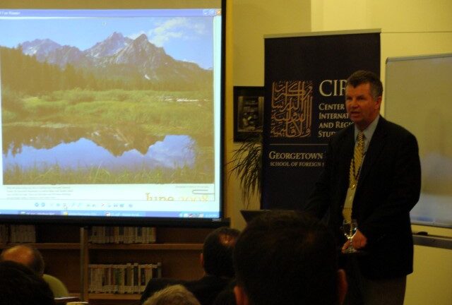
On November 3, 2008, James Reardon-Anderson, Dean of the Georgetown University School of Foreign Service in Qatar, gave a lecture at CIRS’s Monthly Dialogue Series on the connection between “Rainfall and the American Civil War.” Dean Reardon-Anderson explained to the invited audience that the lecture was inspired by a class he regularly teaches entitled “Map of the Modern World,” which is a graduation requirement for all students.
Dean Reardon-Anderson began his lecture by suggesting that one way of understanding human behavior is by examining the fundamental natural forces – earth tectonics and atmospheric physics – that shape the stage on which history has been and is being performed. This lecture, which focuses on the geography of North America and the implications for the outbreak of the American Civil War, is a case study of that phenomenon.
Tectonic forces have produced a North American continent with high mountain ranges in the west and a broad flat plain in the middle, and lodged the center of this continent, which is home to the United States, between 30 and 50 degrees north latitude. Atmospheric forces produce extremely dry conditions at 30 degrees north, the locus of the American Southwest, and prevailing westerly winds across the rest of the country, which cause heavy precipitation over the western mountains, dry conditions on the central plains, and again wet conditions in the east.
The mix of weather conditions and the nature of the physical geography in the southeastern United States meant that the land was arable and conducive to the cultivation of cash crops, especially tobacco, sugar cane, and cotton. Because of the richness of the soil and the bounty of the harvest, these lands were geared towards mass-scale farming, which also meant that hundreds of people were needed to maintain the operations. This manual labor came in the form of slaves from Africa and elsewhere, shipped over to the Americas in order to toil in the fields and produce the crop. The northern areas, by comparison, had little need for such large-scale import of slave-labor, as the temperate weather meant that farming was in the form of small-scale food-crop agriculture. Due to the progressive urbanization and industrialization of the northeast, businesses were largely run by European immigrants and their extended families. In these areas, maintaining slaves during the long winters was, on the contrary, an expensive rather than a cost-effective enterprise.
As more and more communities of people moved west across North America, the territories that applied to join as new states in the United States, grew from 13 in 1789 to 34 in 1861. Until 1850, these states were roughly divided between those in the southern areas and those in the north, and so too between the states that maintained slavery as an important economic enterprise, and those with little or no need for it to sustain their economies.
By the late 1850s, the southern states, whose economy relied on the growth and export of cotton, had exhausted the geographic regions that supported cotton plantations and could not viably expand beyond the areas to which they were confined. As the westward expansion of the North continued and the number of “free” states increased, the South found itself in an increasingly disadvantaged position. This ultimately resulted in the South’s attempt to secede from the union, and the Civil War ensued.
Ultimately, Dean Reardon-Anderson concluded, the levels of rainfall and other similar climatic factors played significant roles in precipitating the American Civil War.
Article by Suzi Mirgani, CIRS Publications Coordinator.